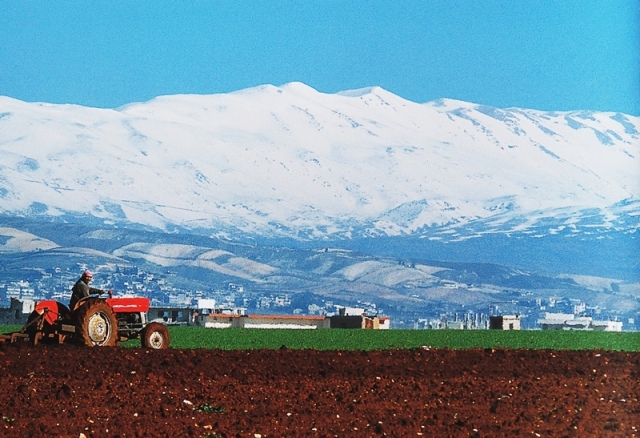
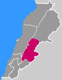
Béqaa
(Arabic:
البقاع, "valley"; also
transliterated as
Béqaa, Biqâ‘ or Becaa) is a
fertile valley in east
Lebanon. The Romans called the Béqaa
Valley the "Breadbasket of the Empire," and today it
remains Lebanon’s most important farming region, and
a major Shia population center in Lebanon.
Geography
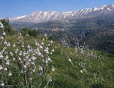
Béqaa
Valley lies about 1,000 meters above sea level and
separates Lebanon’s two mountain ranges. It is
actually an extension of the Great African Rift
Valley.
The Béqaa
is a fertile valley in Lebanon, located about 30 km
(19 miles) east of Beirut. The valley is situated
between the Mount Lebanon to the west and the
Anti-Lebanon mountain ranges to the east. It forms
the northeastern most extension of the Great Rift
Valley, which stretches from Syria through the Red
Sea into Africa. Béqaa
Valley is about 120 km (about
75 miles) in length and has an average width of
about 16 km (about 10 miles). It has a Mediterranean
climate of wet, often snowy winters and dry, warm
summers. The region receives limited rainfall,
particularly in the north, because Mount Lebanon
creates a rain shadow that blocks precipitation
coming from the sea. The northern section has an
average annual rainfall of 230 mm (9 inches),
compared to 610 mm (24 inches) in the central valley.
Two rivers originate in the valley: the Orontes (Asi),
which flows north into Syria and Turkey, and the
Litani, which flows south and then west to the
Mediterranean Sea.
From the 1st century BC,
when the region was part of the Roman Empire, the
Béqaa
Valley served as a source of
grain for the Roman provinces of the Levant. Today
the valley makes up 40 percent of Lebanon's arable
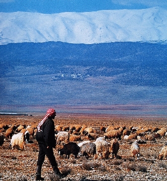
land. The northern end of the valley, with its
scarce rainfall and less fertile soils, is used
primarily as grazing land by pastoral nomads, mostly
migrants from the Syrian Desert. Farther south, more
fertile soils support crops of wheat, corn, cotton,
and vegetables, with vineyards and orchards centered
around Zahle. The valley also produces hashish and
cultivates opium poppies, which are exported as part
of the illegal drug trade. Since 1957 the Litani
hydroelectricity project—a series of canals and a
dam located at Lake Qaraoun
in the southern end of the valley—has improved
irrigation to farms in Béqaa
Valley.
Districts and towns
Zahle is the largest
city and the administrative capital of the Béqaa
Governorate. It lies just north of the main Beirut–Damascus
highway, which bisects the valley. The majority of
Zahle's residents are Lebanese Christian, including
those belonging to the
Armenian
Apostolic Church,
Melkite Greek Catholic Church, Maronite Church, and
members of the Greek Orthodox Church and Muslim
Sunni. The town of Anjar, situated in the eastern
part of the valley, has a predominately Armenian
Lebanese population and is also famous for its
8th-century Arab ruins. The majority of the
inhabitants of the northern districts of Béqaa,
Baalbeck
and Hermel, are Lebanese Shia & Sunni, with the
exception of the town of Deir el Ahmar, whose
inhabitants are Christians. The western and southern
districts of the valley have a mixed population of
majority Sunni, Christian, and Druze Lebanese. The
town of Jib Janine with a population of about 9,000,
is situated midway in the valley, and its population
is Muslims Sunni. Jib Janine is a governmental
center of the region known as Western Béqaa, with
municipal services like the emergency medical
services (Red Cross), a fire department, and a
courthouse.
Due to wars, poverty,
unstable economic and political conditions, and
failures within the agricultural sector, many
previous inhabitants of the valley left for the
coastal cities of Lebanon or emigrated
from the country altogether.
Landmarks
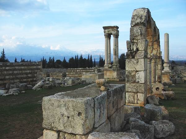
The ancient
Roman ruins of
Baalbeck—probably
the most famous historic site in the valley. An
ancient city named for the Canaanite god Baal. The
Romans renamed Baalbeck "Heliopolis" and built an
impressive
temple complex,
including temples to Bacchus, Jupiter, Venus, and
the Sun. Today, the ruins are the site of the
Baalbeck
International Festival, which attracts artists and
performance groups from around the world.
- Our Lady of
Béqaa, a Marian shrine located in Zahle, with
panoramic views of the valley.
- Lebanon's
tallest minaret, located in the town of Kherbet
Rouha (all Sunni Muslim)
- The Sanctuary of Our Lady of Bechouat
- Phoenician Ruins,
located in the village of Kamid El-Lowz(Population:
Muslim Sunni)
- Roman Ruins,
located in the town of Kab Elias (majority muslim
Sunni)
-The
Umayyad ruins of
Anjar
Formerly known
as Gerrha, a stronghold built by Umayyad Caliph
Al-Walid ibn Abdel Malek in the 8th century, the
site was later abandoned, leaving a number of
well-preserved ruins. (The present-day name derives
from Arabic Ayn Gerrha, or "source of Gerrha".) The
famous
Umayyad
ruins are now a World Heritage Site.
Anjar
In 1939 Anjar in
the Béqaa Valley was a
dry, dusty land, full of insects and deseases such
as Malaria. That's when 5000 Armenian refugees from
Musa Dagh, Turkey, were relocated to Anjar by the
help of the French navy. During the first few months
in exile, more than 500 Anjarians died due to
desease and malnutrition. During that time the
refugees lived under tents. Later, conditions became
better when water fountains and houses, with one
room and an external bathroom, were built by the
help of the French Government.
Anjar is also
known as Haoush Mousa. It is divided into six
quarters: Haji Hababli, Kabusia, Vakif, Khdr
Bek, Yoghun Oluk, and Bitias. Originally, these
names were the names of the six villages of Musa
Dagh.
- Anjar is home
to the Armenian Apostolic Saint Paul Church
which is the second largest Armenian church in
Lebanon.
The population is about 2,400[1, consisting
almost entirely of Armenians. The total area of
its territory is about twenty square kilometers
(7.7 square miles). 50 kilometers from the
capitol of Lebanon, Beirut, with an
altitude of
950 meters
from sea level. In the summer, the population
swells to 3,500, as members of the Armenian
Diaspora return to visit there.
-
- The people of
Anjar are heroic and hard working. Today that
former dry and rugged terrain is transformed
into a green land, full of trees and large
beautiful houses.
-
- Anjar is
famous for its apples. There are more than 500
apple orchards and approximately 50 vineyards in
Anjar. Not all Anjarians are farmers though.
Some farmers rely on the sales of their crops as
their primary source of income. However, the new
generation of teenagers and some older people,
are turning their backs to farming and looking
towards other occupations, such as manufacturing
of jewelry, which is the second largest industry
in Anjar.
-
- There is also
a government sponsored fish farm in Anjar, where
trout and other fresh water fish are raised.
- A very
popular place in Anjar is the spring of Anjar,
where every Sunday hundreds of people from the
surrounding villages gather for picnicking and
dining in the famous Lebanese restaurants, where
fresh water fish is served. The trout is the
most popular fish.
- Every year
during the month of September, commemoration
ceremonies take place near the monument. A
similar celebration simultaneously occurs in the
village of Musaler, Armenia.
Wines
Main article:
Lebanese wine
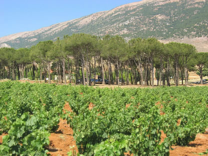
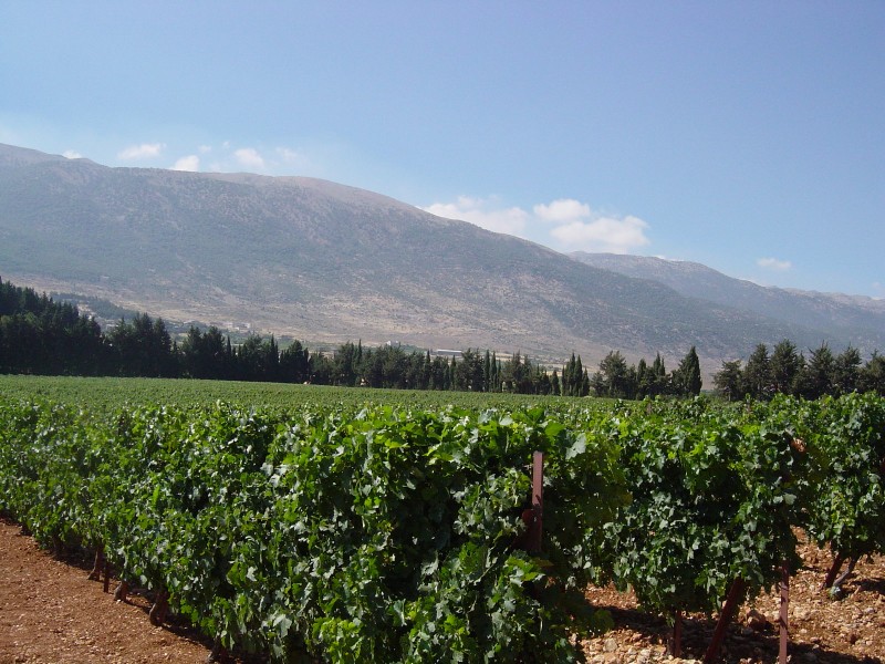
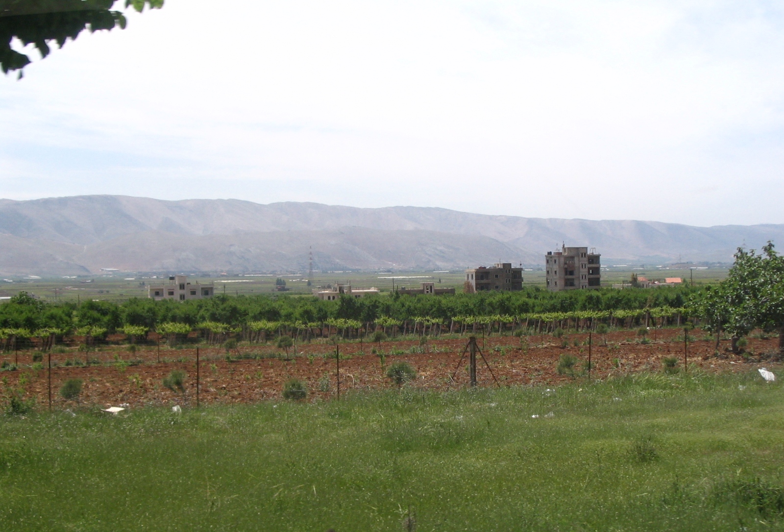
Vineyards
near Zahle, in the central Béqaa
Valley
Wine producing areas in Lebanon (red)
The Béqaa
Valley is Lebanon's most important farming region.
It is also home to its famous vineyards and
wineries. Wine making is a
tradition that goes back 6000 years in
Lebanon.
With an average altitude of 1000 m above sea level,
the valley's climate is very suitable to vineyards.
Abundant winter rain and much sunshine in the summer
helps the grapes ripen easily. There are more than a
dozen wineries in the Béqaa Valley, producing over
six million bottles a year.
Illicit drugs
Drugs have a long
tradition in the Béqaa
Valley, from the days of the Roman Empire until
today cultivators and tribal drug lords working with
militias built up a thriving cannabis trade. During
the Lebanese civil war cannabis cultivation was a
major source of income in the Béqaa
valley, where most of the country's hashish (Grass
in Arabic) and opium was produced, a multi billion
Dollar industry fueling the agricultural sector as
well as political factions and organized crime. The
trade collapsed during the worldwide crackdown on
narcotics led by the United States in the early
1990s. Under pressure from the U.S. State Department,
the occupying Syrian Army plowed up the Béqaa's
cannabis fields and sprayed them with poison. Since
the mid 1990s, the culture and production of drugs
in the Béqaa
valley has been in steady
decline, by 2002 an estimated 2,500 hectares of
cannabis were limited to the extreme north of the
valley, where government presence remains minimal.
Every year since 2001 the Lebanese army plows
cannabis fields in an effort to destroy the crops
before harvest, it is estimated that this action
eliminates no more than 30% of overall crops.
Although important during the civil war, opium
cultivation has become marginal, dropping from an
estimated 30 metric tones per year in 1983 to
negligible amounts in 2004.
Due to increasing political
unrest that weakened the central Lebanese government
during 2006 (Israel attacks on Lebanon) and 2007 (Opposition
boycott of the government) and due to the lack of
viable alternatives (U.N. promises of irrigation
projects and alternative crop subsidies that never
materialized) drug cultivation and production have
significantly increased, but remains a fraction of
civil war era production and limited north of the
Town of
Baalbeck,
where the rule of tribal law protecting armed
families is still strong.
Lebanon’s
breadbasket
Farming remains a
way of life for many Lebanese families, and
agricultural products still generate 12% of the
country’s GDP. Béqaa valley is Lebanon’s most
important farming region - 40% of households run
small family farms here.
Main crops in
Béqaa Valley
|
|
Approximate area in hectares |
|
Cereals (wheat,
barley) |
300,000 |
|
Vegetables (potatoes,
tomatoes, cucumbers) |
260,000 |
|
Fruit (citrus,
grapes, apples, apricots) |
220,000 |
|
‘Industrial
crops’ (sugar beet, tobacco) |
150,000 |
|
Olives |
32,000 |